RampNet
Collection
3 items
•
Updated
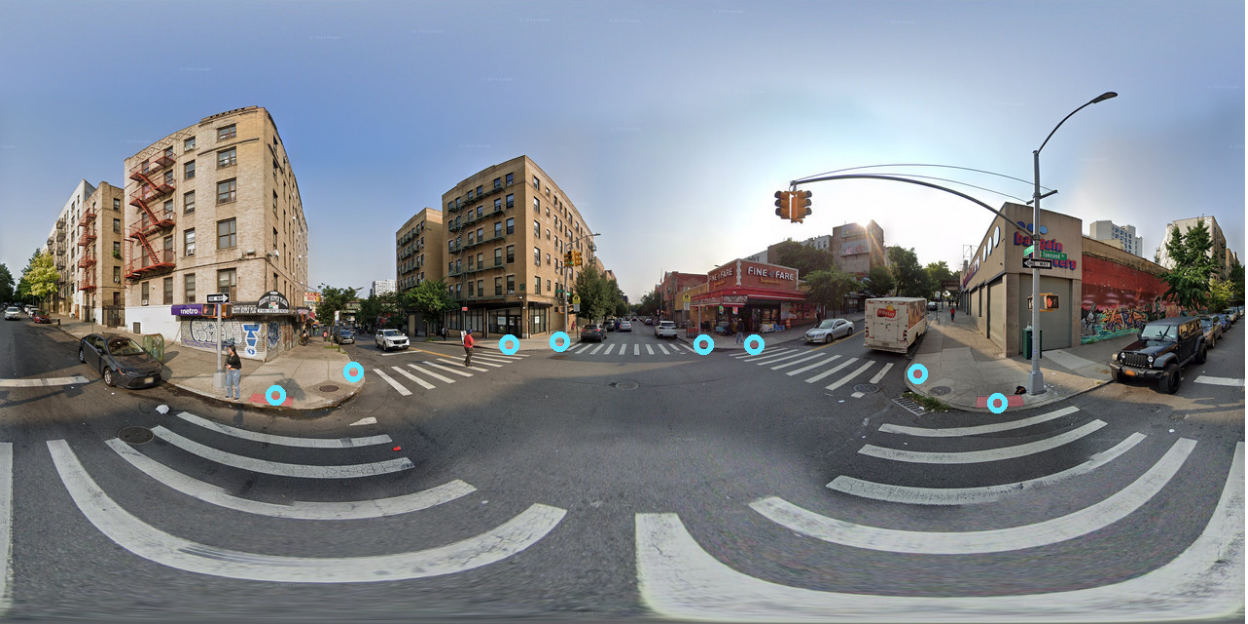
RampNet is a two-stage pipeline that addresses the scarcity of curb ramp detection datasets by using government location data to automatically generate over 210,000 annotated Google Street View panoramas. This new dataset is then used to train a state-of-the-art curb ramp detection model that significantly outperforms previous efforts. In this repo, we provide the checkpoint for our curb ramp detection model.
Usage:
For a step-by-step walkthrough, see our Google Colab notebook, which includes a visualization in addition to the code below.
import torch
from transformers import AutoModel
from PIL import Image
import numpy as np
from torchvision import transforms
from skimage.feature import peak_local_max

IMAGE_PATH = "example.jpg"
DEVICE = torch.device("cuda" if torch.cuda.is_available() else "cpu")

model = AutoModel.from_pretrained("projectsidewalk/rampnet-model", trust_remote_code=True).to(DEVICE).eval()

preprocess = transforms.Compose([
    transforms.Resize((2048, 4096), interpolation=transforms.InterpolationMode.BILINEAR),
    transforms.ToTensor(),
    transforms.Normalize(mean=[0.485, 0.456, 0.406], std=[0.229, 0.224, 0.225])
])

img = Image.open(IMAGE_PATH).convert("RGB")
img_tensor = preprocess(img).unsqueeze(0).to(DEVICE)

with torch.no_grad():
    heatmap = model(img_tensor).squeeze().cpu().numpy()

peaks = peak_local_max(np.clip(heatmap, 0, 1), min_distance=10, threshold_abs=0.5)
scale_w = img.width / heatmap.shape[1]
scale_h = img.height / heatmap.shape[0]
coordinates = [(int(c * scale_w), int(r * scale_h)) for r, c in peaks]

# Coordinates of detected curb ramps
print(coordinates)
Base model
timm/convnextv2_base.fcmae_ft_in22k_in1k_384